Birding Logistics
Beaver Island Birding Trail Checklist
Download the BIBT Checklist to keep track of your birding experience on the Island!

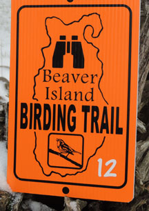
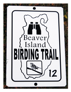
Know The Signs:
White indicates observation from the road.
Orange is a trail; get out and explore!

Beaver Island Birding Trail Birding Sites:
“Every road on the Island offers good birding” -Donna Hardenberg, long time resident and birder

North End Birding Sites:
1. Beaver Island Lighthouse (Whiskey Point Lighthouse)
This lighthouse standing at the mouth of the harbor (Paradise Bay) is visible from almost all points in St. James and is an easy walk or bike ride from the Community Center. Cliff Swallows nest at the lighthouse, and there is access to the shoreline that forms the entrance to Paradise Bay for observing shorebirds and waterfowl.
2. Gull Harbor Natural Area
This protected area is along Gull Harbor Drive east of the Whiskey Point Lighthouse. Most of the habitat is shoreline, cedar shrub, and marshy ponds, but there are a few wooded areas behind the open areas. This is an excellent site to observe waterfowl, wading birds, shorebirds, and raptors. The area is used extensively by migrating songbirds in the spring and fall. During the summer months northern water snakes are active in and around the ponds. These snakes are nonvenomous and should not be disturbed.
3. George and Althea Petritz Preserve
This natural area is managed by the Little Traverse Conservancy and contains several types of habitats, including mixed hardwood/pines and sandy dunes. There is a trail leading from the parking area through the woods to the dunes. Resident songbirds as well as spring and fall migrants utilize the woods, and shorebirds and waterfowl may be found along the beach below the dunes.
4. Chimney Swift Tower
The Chimney Swift Tower on the lawn on the north side of the Government Building was constructed to attract Chimney Swifts both during breeding season and migration. These “flying cigars” normally build their nests inside old masonry chimneys, which are becoming rare across the United States. Conservation organizations throughout the country are involved in constructing towers in an effort to provide these birds with nesting sites; otherwise, the species could face extinction. The base of the tower on Beaver Island contains interpretive signage with more information about Chimney Swifts.
5. St. James Township Campground
This popular campground is located in a mixed hardwoods/pines forest at the top of a high bluff overlooking Garden Island. A paved trail connects the campground to the Donegal Bay Bike Trail which leads back toward town. The woods contain both resident and migrant songbirds and the bluff is an excellent location to look for raptors, including Bald Eagles that nest on the surrounding islands and come to Beaver Island to forage.
6. Indian Point
This area of the island is composed almost entirely of private residences, but the winding roads through the area are good for a slow drive, walk, or bike ride through the second growth forest and clearings of herbaceous plants along the road and around residences. This is a prime spring migration staging area for songbirds, and resident songbirds are common throughout the area. Please be considerate and do not trespass on private property.
7. Font Lake (public boat launch on Donegal Bay Road)
The northernmost inland lake on Beaver Island is shallow with unique floating islands of bog leatherleaf and sweet gale on it. The shoreline consists of both open wetlands and mixed hardwood/conifer forests. Font Lake often supports nesting Common Loons, and Caspian Terns forage in the lake. Bald Eagles, Ospreys, and Northern Goshawks can also be observed. Unfortunately, the invasive Mute Swan is now found inhabiting the lake.
8. Font Lake (Peaine Township Park behind Peaine Township Hall)
A short boardwalk leads from a grassy area behind the township hall through a second-growth forest to a view of Font Lake. Common Loons and various waterfowl species may be visible on the lake. The forest supports several species of songbirds, including Eastern Bluebirds. The two new bluebird houses are designed to provide superior protection from predators and excellent climate control for successful brood rearing.
9. Holy Cross Cemetery
This cemetery sits on a grassy knoll just outside of town. Although it is mown, some grassland bird species, such as the Eastern Meadowlark, may be observed. Please be respectful while in the cemetery.
East Side Birding Sites:
10. East Side Drive north of Welke Airport (Bobolink Bend)
The grassy fields on either side of East Side Drive from the big curve (Bobolink Bend) where the road turns south to the Welke Airport (Island Airways airport) are excellent for observing grassland birds, especially in the summer. Look for Bobolinks, Eastern Meadowlarks, and various sparrow species. Several swallow species forage for insects in the meadows. These fields are privately owned, so please remain on the road to observe birds. In addition, many birds in this area are ground nesters and should not be disturbed during the nesting season.
11. Luney’s Point
This site is Michigan Department of Natural Resources property with access through Little Sand Bay (see #12). The area consists of a swampy forest grading into a cobble beach habitat. Waterfowl and shorebirds may be observed along the shoreline.
12. Little Sand Bay Preserve
(Click here to go to preserve map). This beautiful and varied natural area is managed by the Little Traverse Conservancy. The parking lot is at the edge of a large old field. A two-track leads from the parking lot to a boardwalk trail through a cedar swamp. The trail then continues to a sandy beach that is excellent for swimming, making Little Sand Bay one of the most popular natural areas to visit on the island. Winter Wrens are common in the cedar swamp area, and Indigo Buntings and various sparrow species are found in the old field area.
13. Paula Simpson Trail/Central Michigan University Biological Station Campground/Old Burke Farm
The Paula Simpson Trail begins at the CMU Biological Station sign on the west side of East Side Drive. The trail winds through a series of old beach dunes and swales into a swampy area before ending at the CMU Campground. Winter Wrens and various warbler species are common along the trail. Another short trail leads from the women’s restroom in the CMU Campground to the Old Burke Farm. The trail goes through a swampy area before emerging in a large grassy meadow surrounded by second-growth forest. The field and surrounding forest support various sparrow and warbler species. These trails are closed to the public from May 1-September 30th.
14. Bill Wagner Campground
This beautiful campground owned by Peaine Township is on the shore of Lake Michigan at the south end of Sand Bay. Camp sites are located among large red and white pines, and the beach is a mixture of sand and rocks. In addition to the usual songbirds found in the pines, the beach area affords long range views across Lake Michigan. Bald Eagles and White Pelicans may be seen flying over the water, and Common and Caspian Terns forage on the open lake. Merlins have previously nested in the campground.
15. Seven Bridges Trail
This trail starts across East Side Drive from the entrance to the Bill Wagner Campground just north of the Peaine Township fire station. The trail meanders through a Dry Mesic Northern Forest, considered a threatened natural community by the Michigan Natural Features Inventory. The forest contains thrush species, American Woodcocks, Wood Ducks, and supports other resident songbirds and spring and fall migrants.
16. Johnny Martin’s Trail
This two-track traverses swampy mixed hardwood/conifer woodlands before entering a gravel pit and continuing to an abandoned beaver pond. Woodpecker and warbler species inhabit the forest, and Belted Kingfishers have been known to nest in the banks of the gravel pit.
17. Martin’s Bluff
From the parking lot off East Side Drive a short trail connects to an old two-track that runs parallel to the Lake Michigan shoreline on top of the highest bluff on the east side of the island. This bluff affords spectacular views of Lake Michigan and the mainland. This is a good area to spot birds on the water as well as in the trees along the bluff.
18. Erber Preserve
This small Lake Michigan shoreline natural area is managed by the Little Traverse Conservancy. A short trail from East Side Drive leads through a mixed hardwoods/conifer area to a beach of sand and stone. Warbler species inhabit trees at the edge of the beach, and the beach itself affords long-range views of Lake Michigan where various waterbirds may be observed foraging.
19. Cable’s Creek Road (Warbler Alley)
This road leads to a small parking area where a foot bridge crosses Cable’s Creek. The trail then winds up and over an old dune system primarily covered in conifers until it emerges on the beautiful sand dunes at Cable’s Bay. The varied habitats between East Side Drive and the Cable’s Bay dune system attract many warbler species, both migrant and nesting. The entire area has been nicknamed “Warbler Alley” for the number of warbler species found along the road and trail.
20. Lake Geneserath public boat launch
Lake Geneserath is the largest inland lake on the island. Common Loons have successfully nested here, and waterfowl can be observed foraging on the water. The surrounding beech-maple forest supports woodpecker species and various warblers. Barred Owls can be heard calling at night during the summer months.
21. Beaver Head Lighthouse
The picturesque Beaver Head Lighthouse sits on a high bluff with views to the south of North and South Fox Islands. There are steps leading down the bluff to the beach at the base of the lighthouse. Waterfowl can be observed on the water, and songbirds are easily observed in the treetops below the bluff. There is a population of nesting Chimney Swifts in the area, and several swallow species are often seen flying over the water.
West Side Birding Sites:
22. Barney’s Lake Preserve
This natural area surrounding Barney’s Lake on all but the south side is managed by the Little Traverse Conservancy. There is a parking lot across the road from the lake with a display of a map of the east trail system of the preserve. Common Loons have nested on the lake, and Bald Eagles, Ospreys, and Caspian Terns are often seen flying over the lake. Various sandpipers, Soras, and American Bitterns have been observed along the marshy areas of the shoreline. American Woodcocks can be found along the trails above the lake, and the combination of shrubby and woodland habitats above the lake attracts many species of songbirds.
23. Protar’s Tomb/Kuebler Trail Head
One of the most revered inhabitants of Beaver Island is buried at this site, and one end of the popular Kuebler’s Trail is just off the parking area next to the tomb. This site is in the middle of the northern hardwoods habitat that is prevalent on the west side of the island. Wood warblers are especially common here along with thrush species, various woodpecker species, and Red-eyed Vireos. The Kuebler Trail winds through several habitats, including an old dune system on the west side of Barney’s Lake (see #22) and ends at McCauley’s Point at the south end of Donegal Bay where rolling dunes and a sandy-rocky beach are accessible. At this end, waterfowl and shorebirds may be observed foraging.
24. Bonner’s Bluff Landing
Park at the top of the bluff and walk down the road toward the beach. There is no parking at the bottom, and the road is private. Because the walk begins at the top of Angeline’s Bluff, the highest bluff on the island, the tree tops are level with the road at the parking lot. Therefore, wood warblers and other songbirds can easily be observed. This is an excellent location to spot spring and fall migrants. At the beach at the bottom of the bluff, various shorebirds may be found foraging along the sandy-rocky shoreline.
25. Oliver’s Point via Mrs. Redding’s Trail
This state-owned area on the west side of the island is accessible via Mrs. Redding’s Trail. A trail leads through a conifer forest from Mrs. Redding’s Trail to the shoreline of Oliver’s Point. The beach is very rocky, and walking is difficult, but there is an open grassy meadow before reaching the shoreline that harbors grassland bird species. Winter Wrens and various thrush species can be observed along the trail through the conifers.
26. Greene’s Lake
This shallow lake is a good location for wading birds, such as Great Blue Herons. Sandhill Cranes have been observed here also. Common Loons have previously nested on the lake. The surrounding woods and old fields that are filling in with shrubs yield various warbler and sparrow species.
27. Tara’s Meadow
This clearing is privately owned and should be viewed only from the roadside. It contains Indigo Buntings and various sparrow species. Thrushes and wood warblers can be found in the surrounding hardwood forest.
28. Miller’s Marsh
This extensive natural area managed by Central Michigan University encompasses a biologically diverse ecosystem. The main marsh is a combination of open shallow water and grass and sedge meadows. It is surrounded by hardwood forests and bordered on the east by a leatherleaf bog. North of the marsh are more grass and sedge meadows and a large open field accessible via a two-track road. The red maples along the marsh shoreline are some of the largest on the island. A mile-long trail circles the marsh and allows access to all described habitats. Many species of birds identified on Beaver Island have been observed at this site because of its habitat diversity.
29. Iron Ore Bay
The west side of Iron Ore Bay at the extreme south end of the island is a hot spot for warblers and other songbirds during spring and fall migration. Many species of warblers also nest in the area. The habitat inland from the bay is composed almost entirely of conifers and exemplifies the extensive boreal forests in Canada that serve as breeding grounds for many warbler species.
Central Island Birding Sites:
30. Microwave tower on Sloptown Road
Ospreys nest on the old microwave tower along this road. Young can be seen peering over the nest in late summer, and the adults often sit on snags on the opposite side of Sloptown Road from the nest. Eastern Bluebirds can also be observed in the area.
31. King’s Highway Wetland
This area is known locally as Snipeville because it is a common courting and nesting area for Wilson’s Snipe. Males can be seen and heard displaying in late spring. Other species observed here include Sora, Sandhill Crane, American Bittern, Sedge Wren, Yellow Warbler, Common Yellowthroat, and Red-winged Blackbird.
32. Black Hills Clearing
This site is an old field filling in with young hardwoods and pines. Birds common to shrubby habitats, such as White-throated Sparrows, Cedar Waxwings, and Indigo Buntings are found in this area.
33. Fox Lake
This beautiful lake in the center of the island is surrounded by hardwoods with an extensive bog on the east end. Many bird species utilize this lake, including Bald Eagles, Ospreys, Northern Goshawks, Merlins, Caspian Terns, Great Blue Herons, and American Bitterns. Warblers, both residents and migrants, are found in the woods surrounding the lake.
34. Camp #3 Clear-cut
Formerly a mature hardwood forest, this area was clear-cut to increase habitat for deer and game birds. The now dense shrubby habitat attracts Indigo Buntings, American Woodcocks, and Ruffed Grouse.
35. Hannigan’s Road
This scenic road that cuts across the island travels through several types of habitats, including swampy forests and old fields. Woodpecker species, American Woodcock, and Ruffed Grouse can be observed along with resident and migrant songbirds. Because the road is not heavily used, it is conducive to biking or slow driving.


